Desafío
El operador de infraestructuras ferroviarias del Reino Unido, Network Rail, es responsable de alrededor de 190.000 estructuras de tierra, que incluyen un gran número de desmontes y terraplenes empinados. La mayoría de estas estructuras se construyeron hace más de 130 años y, por tanto, son anteriores a los estándares geotécnicos modernos y a las buenas prácticas actuales. El funcionamiento seguro y eficiente del ferrocarril depende de la estabilidad de estas estructuras, y los fallos —como los deslizamientos de tierra en los taludes de los desmontes adyacentes a la vía— pueden causar interrupciones significativas y situaciones de peligro.
El número de este tipo de fallos está aumentando como consecuencia de los cambios en los patrones meteorológicos, que han provocado periodos cada vez más frecuentes de lluvias extremas.
Algunas de las rutas situadas al sur y al oeste de Londres, en las regiones de Kent, Sussex y Wessex, son especialmente vulnerables a estos eventos, ya que muchos taludes de desmonte son empinados, están muy próximos a la vía y están formados por capas de creta permeable sobre arcilla impermeable.
Con el fin de mitigar el riesgo creciente asociado a su inventario de estructuras de tierra, los ingenieros y gestores de activos de Network Rail recopilan una amplia variedad de datos para orientar su estrategia de gestión de activos.
Solución
El uso de la monitorización remota inalámbrica se ha convertido en una parte integral de este proceso de recopilación de datos. En 2018, una instalación a pequeña escala de 20 sensores de inclinación y dos cámaras en Barnehurst, en la línea Bexleyheath, proporcionó a Network Rail la advertencia suficiente de un deslizamiento de tierra como para detener los trenes y evitar una colisión con toneladas de tierra y vegetación.
Tras este éxito, se tomó la decisión de invertir aproximadamente 6 millones de libras esterlinas en la monitorización inteligente de obras de tierra en Kent y Sussex, con el objetivo de poner el sistema en funcionamiento antes de la temporada de tormentas invernales de 2020/21.
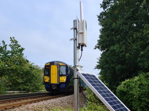
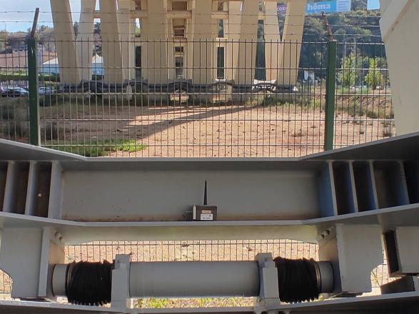
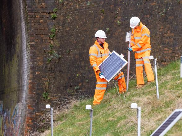
Un despliegue típico de InfraGuard™ consta de filas desplazadas de nodos sensores de inclinación fijados a estacas metálicas, junto con una pasarela de comunicaciones 4G y una cámara 4G capaz de operar prácticamente en cualquier condición de iluminación.
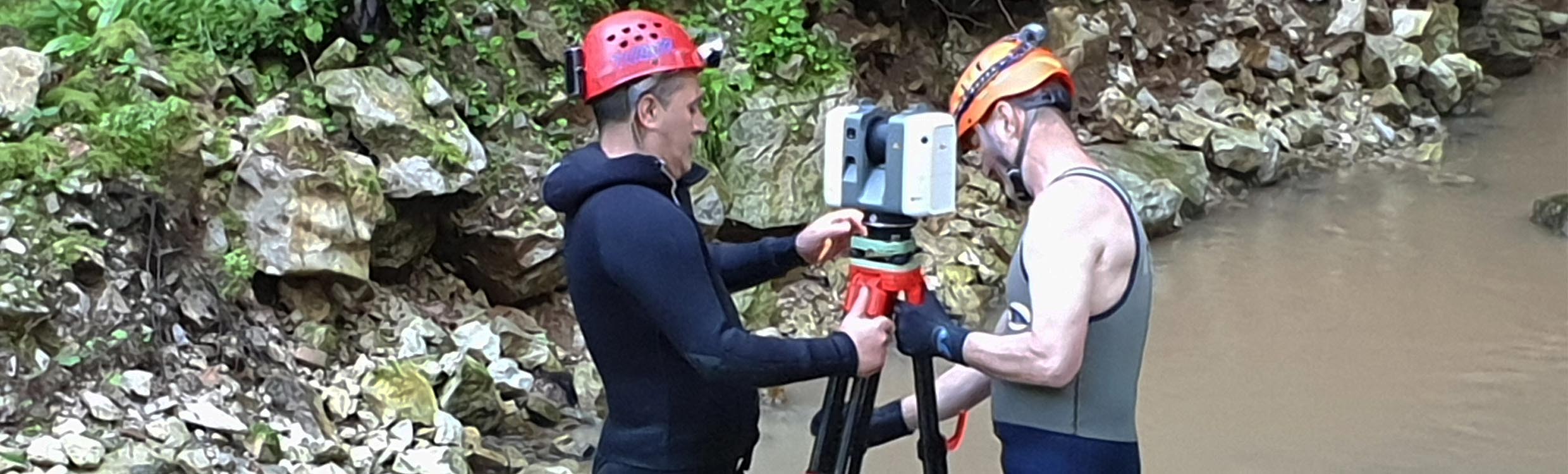
Con el fin de que el despliegue fuera eficiente y lo suficientemente sencillo como para ser realizado por personal no especializado, se adoptó un enfoque estandarizado. Cada emplazamiento se dividió en bloques de 100 m. Dentro de cada bloque se instalaron 50 nodos de sensores de inclinación, dos cámaras y una pasarela de comunicaciones celulares alimentada por energía solar.
La solución es flexible y escalable. En algunos emplazamientos se desplegaron solo unos pocos sensores de inclinación y un par de cámaras. El emplazamiento más largo, en Haywards Heath, contaba con 20 pasarelas, 40 cámaras y 996 sensores de inclinación. En la primera fase del despliegue se instrumentó una longitud total de 9,7 km en Sussex y 12,7 km en Kent.
La instalación a esta escala aportó importantes mejoras de eficiencia. Hacia el final del proyecto, una instalación completa de 100 m podía realizarse en un turno de cinco horas. Esto incluía estudios ecológicos, topográficos y de servicios enterrados, desbroce selectivo de vegetación, instalación de nodos, cámaras y la pasarela con su panel solar, y la realización de un levantamiento “as-built”. La instalación del sistema de monitorización fue llevada a cabo por contratistas sin experiencia previa. Gran parte del trabajo se realizó sin necesidad de cortes de línea.
Para el proyecto se desarrolló un flujo de trabajo estándar. El sistema quedaba activo antes de que el equipo abandonara el emplazamiento y la configuración y validación final eran completadas por Senceive, normalmente en el plazo de unos días. A continuación, el flujo de datos y la documentación eran revisados y aprobados por el gestor de activos de la ruta de Network Rail y, una vez validados, se enviaban al centro de control de la ruta. El sistema emplea una serie de cuatro niveles de alerta basados en la magnitud del movimiento registrado.
Resultado
En marzo de 2022, el sistema estaba instalado en más de 40 kilómetros de vía, utilizando más de 20.000 sensores de inclinación, 750 cámaras y 500 pasarelas de comunicación.
El sistema proporciona alertas automáticas validadas mediante imágenes fotográficas, lo que reduce significativamente el riesgo de falsas alarmas. Esto también disminuye el número de visitas al emplazamiento necesarias, con beneficios claros en términos de ahorro de tiempo, reducción de la huella de carbono y mejora de la seguridad.
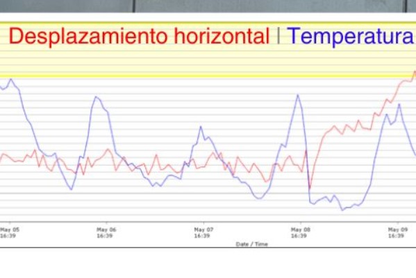
La información proporcionada por el sistema InfraGuard™ permite la identificación temprana de pequeños movimientos y la detección casi en tiempo real de movimientos bruscos. Ha demostrado ser eficaz en el seguimiento de la evolución de fallos de taludes, como un deslizamiento de tierras en la aproximación al túnel de Wadhurst. Los niveles detectables de movimiento del suelo en este tipo de fallos pueden desarrollarse a lo largo de días, horas o incluso minutos.
Una característica clave es la tasa de generación de informes dinámica, lo que significa que la frecuencia de muestreo cambia automáticamente en respuesta a eventos de movimiento de distinta gravedad. Esto ayuda a los usuarios a detectar señales tempranas de movimiento, a supervisar movimientos continuos o repentinos y a identificar falsas alarmas.
Gracias a que las baterías de los sensores tienen una duración de varios años, InfraGuard™ es una solución ideal a largo plazo para la detección de eventos repentinos como deslizamientos de tierra y fallos de taludes, ya que la tecnología ofrece un alto nivel de confianza en que las partes interesadas serán notificadas del movimiento del terreno y podrán disponer de una visión inmediata de los posibles problemas, todo ello sin necesidad de desplazarse al lugar.